Graph creation
[1]:
import geopandas as gpd
import sys
sys.path.append('..')
import osmnx as ox
Initialization
The drive graph is generated using the polygon GeoDataFrame and the local CRS.
Ensure that the local CRS is a Projected CRS (e.g., UTM) rather than a Geographic CRS (e.g., EPSG:4326 - WGS84) to maintain accurate distance calculations.
[2]:
geocode= 81993 # Tula oblast geocode from OSM
polygon = ox.geocode_to_gdf(f'R{geocode}', by_osmid=True)
local_crs = 32637
[3]:
from transport_frames.graph import get_graph_from_polygon

graph = get_graph_from_polygon(polygon,local_crs)
2025-03-01 07:15:51.923 | INFO | iduedu.modules.drive_walk_builder:get_drive_graph_by_poly:91 - Downloading drive graph from OSM, it may take a while for large territory ...
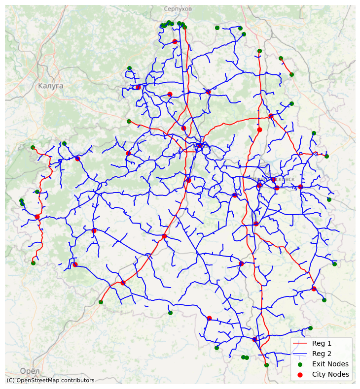
Frame
Frame consists of federal and regional roads from the graph, adding exit attributes and district centers attributes to the nodes.
[4]:
regions = gpd.read_file('regions.geojson')
admin_centers = gpd.read_file('region_points.geojson')
[5]:
from transport_frames.frame import get_frame, plot_frame

f = get_frame(graph,admin_centers,polygon,regions)

plot_frame(f)
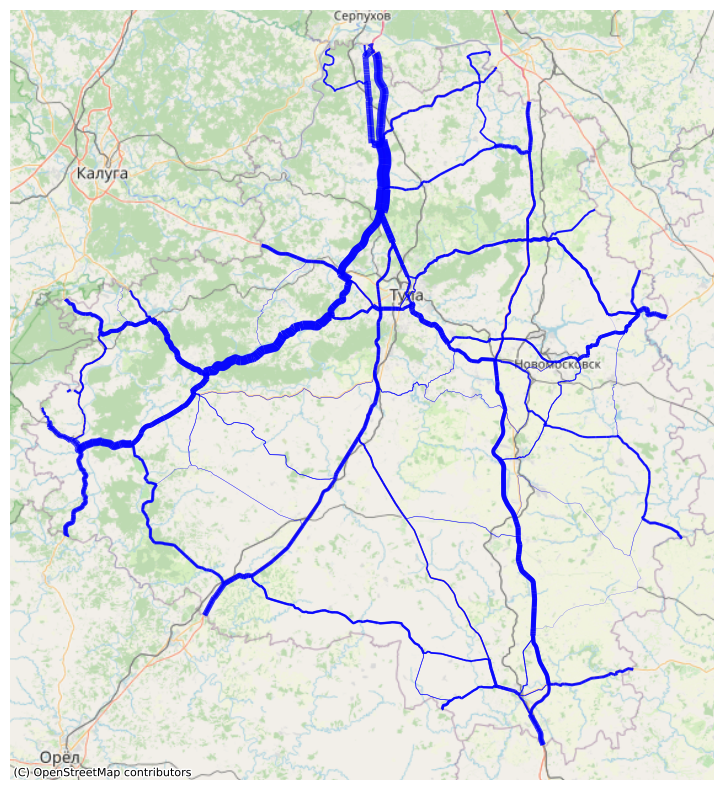
Weighted frame
Weights are assigned to the edges and nodes based on the expected popularity of the path between pairs of exits.
[6]:
from transport_frames.frame import weigh_roads, plot_weighted_roads

weighted_frame = weigh_roads(f)

plot_weighted_roads(weighted_frame)
Intermodal graph
Intermodal graph is used for connectivity indicators and routes extraction. It can be obtained using iduedu library.
[ ]:
from iduedu import get_intermodal_graph

inter_graph = get_intermodal_graph(osm_id=geocode)